Map of Eastern Lycia (MO) |
 |
| EWP 2015.
Size: 870x560, folded to 220x140mm, self-cover. 1:54,000. Cost includes postage (untracked) & packaging. | |
| Code: MO | ISBN: 9781906449254 |
|---|---|
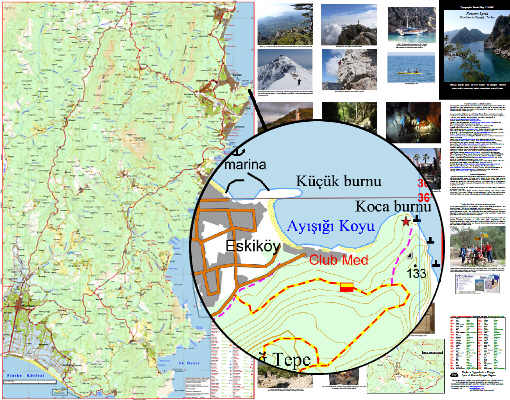
| Detailed, full-colour topographical map covering the Eastern Lycia, Turkey. Covering Adrasan, Beycik, Çıralı, Göynük, Mount Olympos, Kemer, Tekirova. Walking Routes including eastern Lycian Way, mountain routes. Archaeological sites, caves, hospitals, hotels, markets, mines, police posts, power lines, rock climbing, schools, service stations, Useful contacts and word glossary in English, German and Turkish. Photographs of area.  GPS=5 GPS=5 | |